Most visitors to the Chesapeake Bay see a broad, glittering expanse of water and assume it has always been there — ancient, permanent, inevitable. It hasn't. The Chesapeake is, in geological terms, a newcomer. It is also, beneath its surface, something stranger and more dramatic than it first appears: a meteor scar, a drowned valley, a river running in slow motion toward its own erasure. Understanding the geology of the Chesapeake Bay doesn't just satisfy curiosity — it explains why the bay looks the way it does, why certain ports became historically significant, and why some communities are running out of time.
A River Beneath the Bay: The Susquehanna's Ancient Path
The most fundamental fact about Chesapeake Bay geology is one that reshapes how you see the water entirely. The Chesapeake Bay is a 'drowned river valley' — the submerged ancient bed of the Susquehanna River, flooded by rising sea levels at the end of the last ice age roughly 10,000 years ago. What you are looking at when you stand on the shore is, in essence, a river that the ocean swallowed.
During the last glacial maximum, sea levels globally were dramatically lower than they are today — by estimates of well over 300 feet in some regions. The continental shelf along the Atlantic coast was exposed dry land, and the Susquehanna River flowed southeastward across it, draining much of what is now the mid-Atlantic interior and emptying far out into the Atlantic Ocean beyond the current shoreline. Its tributaries — the Potomac, the Patuxent, the Rappahannock, the James — carved their own valleys into the coastal plain as they descended to meet it.
Then the ice retreated. Meltwater flooded back into the world's oceans over thousands of years, and the sea crept inland across the exposed shelf. The Susquehanna valley didn't disappear — it flooded. The valley became a bay, the tributary valleys became the distinctive 'fingers' of water that give the Chesapeake its characteristic branching shape on any map. Every major river that enters the bay from the west is, in this sense, a stream still trying to reach a river mouth that no longer exists at the surface.
The Depth Map That Tells the Old Story
The ghost of the Susquehanna is most legible in the bay's depth profile — one of the most telling features of the bay's geology for anyone who wants to understand it. The unusual depth profile of the Chesapeake — relatively shallow on average at about 21 feet, but with a deep central channel exceeding 100 feet — is a direct consequence of the ancient Susquehanna River channel carved during lower sea levels.
💼 Career Opportunities
That deep central trench running the length of the bay isn't a random feature of the seafloor. It is the old riverbed, carved by millions of years of flowing water into the softer sediments of the coastal plain. The shallower surrounding areas are the old floodplains, terraces, and uplands of the ancient river valley. When you look at a nautical chart of the Chesapeake and see that dramatic contrast between the central channel and the extensive shoals to either side, you are looking at a topographic map of a landscape that existed before human memory.
This depth variation has had enormous practical consequences. The deep channel allowed large vessels to navigate far inland — up to Baltimore, up toward Washington — while the shoals and shallows made seamanship treacherous without local knowledge. Colonial-era sailors and their Indigenous predecessors before them learned the bay's bottom as carefully as its surface, because grounding on a shoal that was once a riverbank could be as fatal as any storm.
The Deeper Wound: A Meteor Crater at the Bay's Foundation
The Susquehanna's drowned valley explains the bay's shape. But to understand why the lower bay — its southern end near the Virginia shore — behaves differently from the upper bay, you have to go back much further than the ice age. You have to go back 35 million years to an event of extraordinary violence.
A meteor impact approximately 35 million years ago created the Chesapeake Bay Impact Crater, one of the largest known impact craters in the United States, centered near the mouth of the bay at Cape Charles, Virginia. The impactor — likely a comet or asteroid — struck what was then a shallow sea covering the mid-Atlantic coastal plain. The resulting crater is estimated to be roughly 85 miles wide, making it one of the largest known impact structures in the world, not just in the United States.
The crater was buried under tens of millions of years of sediment and wasn't identified until relatively recently, when geologists began noticing anomalies in the subsurface geology of the lower Chesapeake region. Cores drilled from the area revealed shattered and melted rock, shocked quartz, and other unmistakable signatures of a hypervelocity impact. The discovery reframed the entire geological story of the region.
How the Crater Influences the Bay Today
Even buried under layers of sediment, the crater's legacy is active. The impact shattered and fractured the underlying rock across a vast area, creating what geologists call a 'disturbed zone' of collapsed and jumbled material. This fractured foundation compacts and settles differently than intact geology — and that differential settling contributes to the fact that the land surface around the lower Chesapeake and the Delmarva Peninsula subsides faster than areas farther north.
Land subsidence is not unique to the Chesapeake region, but the crater amplifies it here. Combined with the global rise in sea levels, this local sinking of the land means that the effective rate of relative sea level rise around the lower bay is among the highest on the Atlantic coast. The geology set the stage for a problem that is now playing out in real time for communities living on low-lying ground.
The crater also helps explain the odd groundwater chemistry of the lower bay region. Wells drilled deep in the affected zone encounter water that is highly saline — an ancient remnant brine from the impact event and subsequent geological history — which has long complicated freshwater access in parts of the Virginia coastal plain.
What the Geology Made Possible: Colonial Ports and Strategic Geography
The drowned river valley didn't just create a bay. It created a specific kind of bay — one with deep navigable water reaching far inland, flanked by natural harbors where tributary valleys met the main channel, in a region where the coastal plain provided flat, tillable land close to the water's edge. For early European colonists arriving with sailing ships and an agricultural economy, this was close to an ideal configuration.
The deep channel of the old Susquehanna meant that oceangoing vessels could reach points well above the fall line's vicinity without the dredging or infrastructure that would have been needed on a shallower coast. The tributary estuaries — the Potomac, the James, the York — offered protected anchorages and navigable routes into the interior. Tobacco plantations could be established on the banks of these rivers and load their hogsheads directly onto ships without moving goods to a distant central port. The decentralized, river-plantation model of early Chesapeake agriculture was, at its foundation, an adaptation to a geological landscape that made direct waterfront access practical on an unusually large number of sites.
Baltimore's rise as a major port in the 18th century is similarly a story written in geology. Sitting at the head of navigation on the Patapsco River where it joins the upper bay, Baltimore was positioned to receive grain and flour coming down from the Pennsylvania interior and ship it to Atlantic markets. The deep channel gave it access; the geology of the surrounding countryside gave it the agricultural hinterland. Its harbor is, like the bay itself, a valley the sea has partly reclaimed.
Disappearing Ground: Erosion, Subsidence, and the Bay's Threatened Communities
The same processes that created the Chesapeake — rising seas reshaping a low-lying landscape — did not stop 10,000 years ago. They are continuing, and in some places accelerating. The bay's shoreline has been shifting and eroding since the moment the ocean first entered the Susquehanna valley. What has changed in the modern era is the rate, and the presence of human communities whose existence depends on stability.
Soft sedimentary shores, which make up much of the Chesapeake's shoreline, erode more readily than hard-rock coasts. The low relief of the coastal plain means that even modest changes in water level translate into significant landward movement of the shoreline. Islands that existed at European contact have already disappeared entirely beneath the bay's surface — Holland Island, accessible by boat into the 20th century, is now largely submerged.
Tangier Island in the Virginia portion of the Bay, inhabited since the late 17th century, has lost significant land mass to erosion and rising water and is considered one of the most threatened communities in the United States due to sea level rise. Tangier sits on a remnant of the coastal plain barely above sea level, exposed to the open bay on multiple sides, and sustained by a fishing community whose roots stretch back centuries. The island's predicament is not primarily a story of human error or poor planning — it is a story of geology operating on timescales that human habitation assumed were stable.
Reading the Landscape as a Visitor
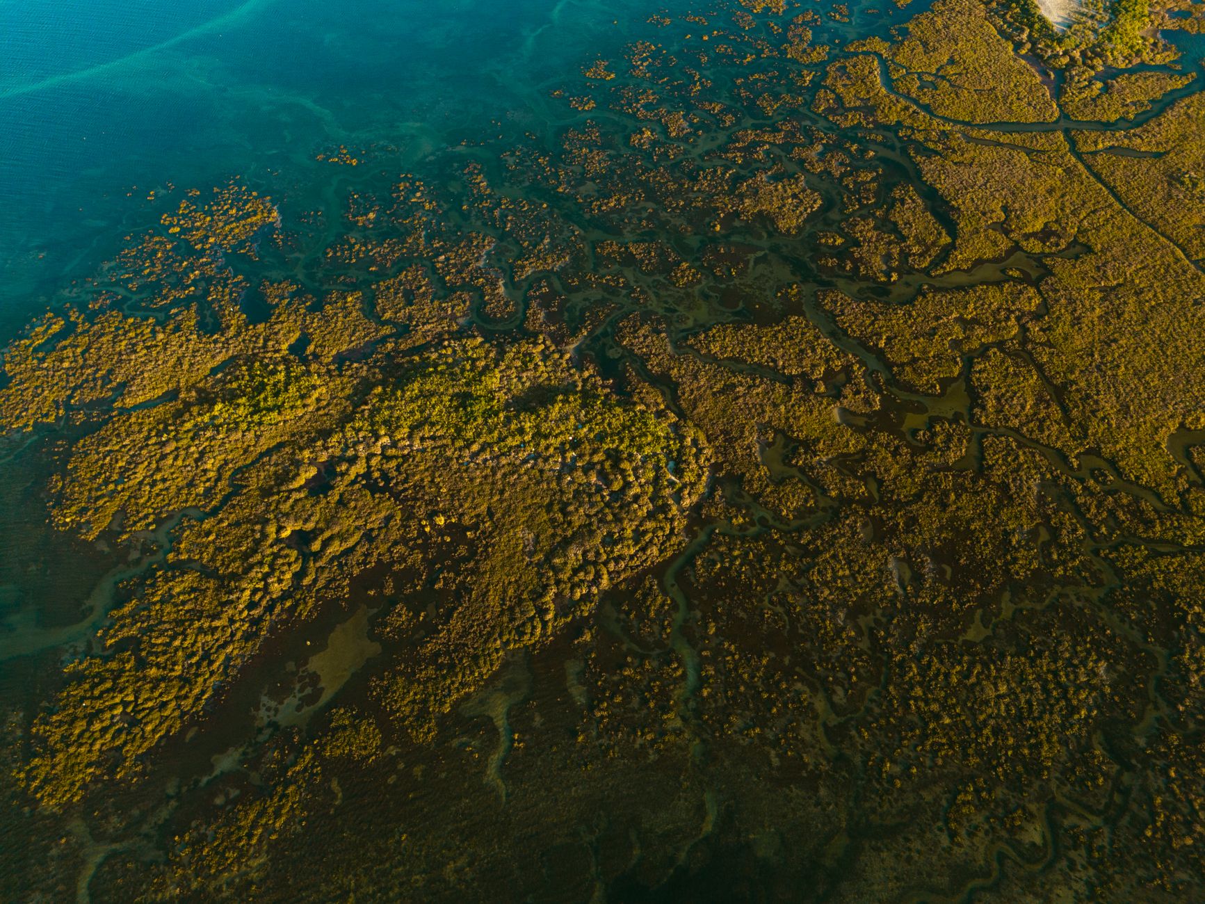
For anyone exploring the Chesapeake region today, the geological history is legible everywhere once you know what to look for. The wide, funnel-shaped mouths of the bay's tributaries — far wider than a river would need to be for its current flow — are the signature of drowned valleys. The broad, flat peninsulas between rivers are the high ground between those old valleys, the uplands of an ancient drainage system. The dramatic difference between the rocky, resistant shores of some northern parts of the bay and the soft, crumbling cliffs of calcareous sediment visible along stretches of the Calvert Cliffs in Maryland reflects the underlying geology of the coastal plain, where Miocene-era marine sediments — deposited in seas that covered the region long before the ice ages — now erode from the bluffs and expose a remarkable fossil record of sharks' teeth and marine mammals.
The bay's geography, in other words, is not background scenery. It is the direct product of a meteor strike 35 million years ago, a river system carving its valley over millions of years, a glaciation that locked up vast quantities of water, a deglaciation that released them, and a coastal plain that has been in slow, ongoing negotiation with the sea for as long as there has been a coast. Every port, every island, every shallow shoal and deep trench is a sentence in that story.
Why This Geology Still Matters
Understanding the Chesapeake's geological origins isn't merely an exercise in deep history. It is essential context for some of the most pressing practical questions facing the region: Which shorelines are most vulnerable and why? Where does land subsidence compound the challenge of rising water? Why do some areas face saltwater intrusion into freshwater aquifers while others don't? How did the shape of the landscape determine where people settled, what they could grow and ship, and what communities came to exist in the first place?
The bay is young by geological standards and old by human ones, and it is still changing. The Susquehanna continues to flow into it, still following something close to its ancient course even if the valley it carved is now underwater. The crater at its mouth continues to influence the settling of the land above it. The sea that drowned the old river valley continues to rise. The Chesapeake Bay is, among many things, a demonstration that geology is not a story that ended — it is one that every generation of inhabitants walks into mid-chapter, whether they know it or not.
Sources
Every factual claim in this article was independently verified against the following sources:
- Chesapeake Bay - New World Encyclopedia — newworldencyclopedia.org
- Chesapeake Bay Impact Crater - Northampton County — co.northampton.va.us
- A “way of life” at risk: The race to save Virginia's Tangier Island from erosion and sea level rise — whro.org
- The Chesapeake Bay and Its Watershed - Cloudfront.net — d38c6ppuviqmfp.cloudfront.net