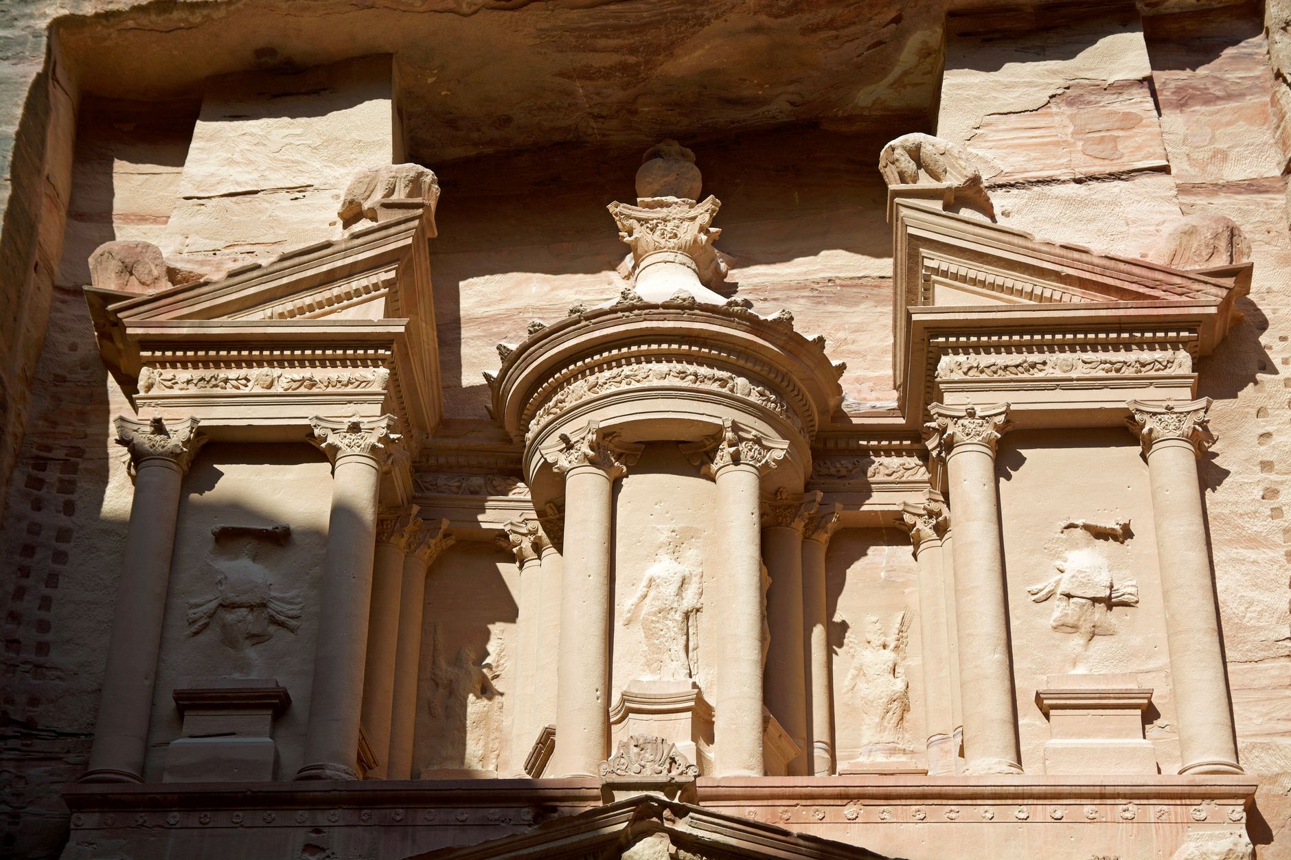
There is a moment, walking through the narrow slot canyon called the Siq, when the scale of human ambition becomes almost incomprehensible. The sandstone walls close in around you, rising to heights that block out most of the sky, and then the passage opens — suddenly, dramatically — to reveal a carved facade of columns, pediments, and urns cut directly into the cliff face. This is Al-Khazneh, the Treasury, the most famous face of Petra. But it is not the most important thing the Nabataeans built here. That distinction belongs to something far less photogenic: the pipes, dams, cisterns, and channels that turned a sun-blasted canyon in the Jordanian desert into a city capable of sustaining tens of thousands of people. Understanding that water system is understanding why Petra exists at all.
Who Were the Nabataeans?
The Nabataeans are one of antiquity's great under-told stories. They were an Arab people who emerged as a distinct political and commercial force sometime in the fourth century BCE, and their kingdom stretched across what is now southern Jordan, the Negev desert, the Sinai, and parts of northwestern Arabia and southern Syria. They were not primarily warriors or farmers — they were traders and engineers, and those two identities were inseparable.
Petra served as the capital of the Nabataean Kingdom from approximately the 4th century BCE until the Roman annexation in 106 CE. For roughly five centuries, therefore, this canyon city in the highlands of modern Jordan sat at the center of one of the ancient world's most lucrative commercial networks. Petra's strategic location at the crossroads of trade routes connecting Arabia, Egypt, and the Mediterranean allowed the Nabataeans to control and tax the flow of frankincense, myrrh, spices, and silk passing through the region. They did not merely participate in this trade — they managed it, taxing caravans and providing the water, fodder, and security that made long desert crossings survivable. Their wealth was real, and their city reflected it.

As an Amazon Associate, I earn from qualifying purchases.
The Canyon That Should Have Stayed Empty
Look at Petra on a map and the location seems absurd. The city sits inside a basin of eroded sandstone mountains in the southern Jordanian highlands, accessible through narrow canyon passages that would funnel any attacking army into a killing ground but that also channel flash floods with terrifying force. Annual rainfall in the region is low and highly unreliable. There are no rivers. The summer heat is ferocious. By any conventional measure of site selection, a city of tens of thousands should not have been built here.
💼 Career Opportunities
The Nabataeans built it here anyway, and they made it work through an engineering program that modern hydrologists still study with admiration. The canyon's apparent liabilities — its flash floods, its narrow passages, its geology — were transformed into assets through systematic, city-scale water management. The hostility of the environment was not ignored; it was redirected.
The geological formations of the Petra basin were central to this calculation. The sandstone and limestone of the surrounding mountains act as natural aquifers, storing winter rainfall and releasing it slowly through seeps and springs. The Nabataeans identified every such source, mapped the topography with precision, and built a network that collected, transported, stored, and distributed water across the entire urban area.
The Engineering of Survival: Dams, Channels, and Cisterns
The Nabataean water system at Petra operated on multiple scales simultaneously. At the largest scale, they managed the flash floods that periodically roared through the Siq and other canyon passages. These floods were genuine threats — powerful enough to move boulders and destroy anything built in their path. The Nabataeans constructed a diversion dam at the entrance to the Siq, rerouting floodwaters through a tunnel cut through the rock so that the water was channeled away from the main city rather than through it. This single engineering decision is what made the Siq itself usable as a processional entrance rather than a seasonal death trap.
At the intermediate scale, they built hundreds of cisterns cut directly into the bedrock across the surrounding hillsides. These cisterns collected rainwater during the winter wet season and held it through the long dry summer. Estimates based on archaeological surveys suggest the system could store enormous quantities of water — enough to supply a population far larger than the canyon's natural springs could support alone.
At the street level, ceramic pipes ran through the city carrying water from the spring at Ain Musa — Moses' Spring, as later tradition called it — several kilometers into the urban core. These weren't rough clay troughs; they were fired terracotta pipes with sealed joints, engineered to maintain pressure and prevent contamination. The pipes ran alongside the colonnaded street that formed Petra's main commercial artery, feeding fountains, pools, a monumental nymphaeum, and private households. The entire system was gravity-fed, using the natural topography of the basin to move water without pumps.
Why the Water System Explains the City's Shape
Once you understand the water infrastructure, the layout of Petra begins to make a different kind of sense. The placement of temples, markets, and residential areas follows the logic of water availability as much as it follows social hierarchy or commercial convenience. The great civic monuments cluster in the valley floor where water could be reliably delivered. The rock-cut tombs and religious high places occupy the surrounding cliffs — spaces that required no daily water supply. Even the famous carved facades, the thing that most visitors come to see, reflect this logic: cutting rooms and ceremonial spaces directly into the cliff face required no construction materials and no water supply, only labor and skill.
The iconic monument known as Al-Khazneh (the Treasury) stands approximately 40 meters high and was carved entirely from the surrounding rose-red sandstone cliff face rather than constructed from assembled blocks. This method of construction — subtraction rather than addition, removing stone rather than stacking it — appears throughout Petra on a massive scale. There are hundreds of carved structures here, from simple tomb chambers to elaborate multi-story facades with Greek-influenced columns and Nabataean crow-step ornamentation. The geology made this possible: the local sandstone is soft enough to carve relatively easily but hard enough to hold structural detail for centuries.
A City of Trade, Not Just Stone
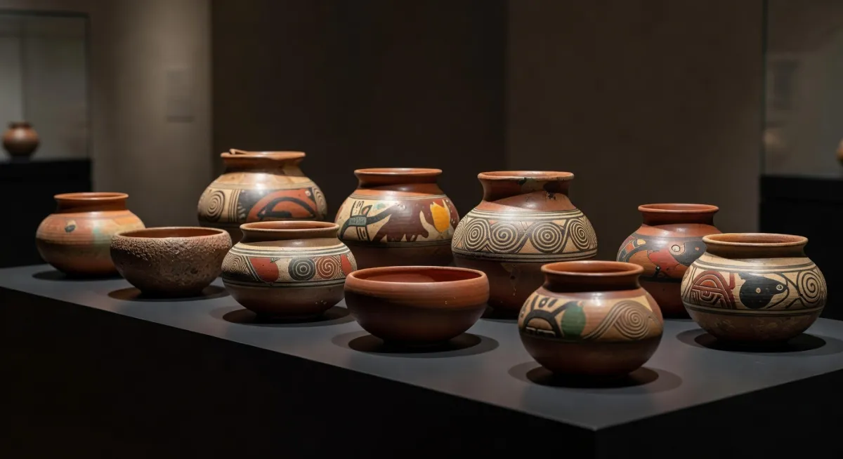
It would be a mistake to think of Petra primarily as a necropolis, even though many of its most visible monuments are tombs. At its height — probably in the first century BCE and first century CE — Petra was a cosmopolitan commercial city with a population that may have reached tens of thousands. Its markets handled goods from three continents. Its coinage circulated across the Near East. Its pottery, immediately recognizable to archaeologists for its extraordinary thinness and painted geometric decoration, has been found at sites from Rome to India.
The Nabataeans were unusual among ancient peoples in several respects. Their women appear to have held relatively high social status — Nabataean inscriptions record women owning property and conducting business independently. Their script was the direct ancestor of modern Arabic writing. And their religious practices centered on abstract, often aniconic representations of deities — carved blocks and standing stones rather than figurative statues — which set them apart from many of their neighbors.
Trade was the city's oxygen, and the Nabataeans understood that their continued prosperity depended on making the Petra route more reliable and better serviced than any alternative. This meant not just water management within the city but a chain of watered stopping points across the desert — caravanserais and cisterns at regular intervals along the routes north toward Damascus, west toward Gaza, and south toward the Red Sea port of Aila (modern Aqaba). Petra was the hub of this network, and the network was only as strong as its weakest waterhole.
The Roman Annexation and What Came After
In 106 CE, the Roman emperor Trajan absorbed the Nabataean Kingdom into the empire as the new province of Arabia Petraea. The transition appears to have been largely peaceful — there is no evidence of a military conquest, and Petra continued to function as a major city under Roman administration. The Romans, in their methodical way, added a colonnaded street, a monumental arch, bathhouses, and a large temple complex. They were building on top of a city that was already, by any standard, impressively developed.
But Petra's commercial centrality gradually declined. The growth of rival trade routes, particularly sea routes through the Red Sea and overland routes through Palmyra in Syria, reduced the volume of traffic through the canyon. By the third century CE, Petra was contracting. A catastrophic earthquake in 363 CE damaged the city severely and accelerated its abandonment as a major urban center. By the early Islamic period, the great commercial city had dwindled to a small community, and its canyon eventually became home only to the Bdoul, a Bedouin tribe who lived in the tombs and caves until the late twentieth century.
What Remains Beneath the Surface
Modern archaeology has only begun to reveal how much of Petra remains unexamined. Archaeological surveys using satellite imaging and ground-penetrating radar, including a major 2016 study published in the Bulletin of the American Schools of Oriental Research, have revealed substantial monumental structures beneath Petra's surface that remain unexcavated. One notable discovery from that study was a large platform and monumental staircase near the city center — a structure comparable in scale to the famous monuments above ground, hidden under centuries of windblown sediment. The implication is striking: what visitors see at Petra today is a fraction of what was built there.
Excavations that have been conducted reveal layers of occupation and rebuilding that complicate simple narratives. The water system itself was modified and expanded repeatedly over centuries, with Roman engineers adding to and adapting what the Nabataeans had built. Understanding the full sequence will take generations of careful excavation.
Visiting Petra Today
UNESCO inscribed Petra as a World Heritage Site in 1985, and it was named one of the New Seven Wonders of the World in a 2007 global poll. The site draws hundreds of thousands of visitors annually, and the tension between conservation and access is genuine. The sandstone that makes Petra so beautiful is also fragile — foot traffic, humidity from large crowds, and the vibration of hooves (horses and donkeys are still used in parts of the site) all cause measurable deterioration.
The experience of Petra is physically demanding in ways that photographs don't convey. The site covers an area of several square kilometers, the terrain is rough, and the most rewarding monuments — including the Monastery, Ad-Deir, which rivals the Treasury in scale and surpasses it in setting — require serious hiking. Those who go beyond the main tourist circuit and hidden hiking trails through the surrounding mountains discover a landscape that has changed relatively little since camel caravans moved through it two thousand years ago.
The best practical advice for first-time visitors is to arrive early in the morning before the main crowds, to allocate at least two full days, and to spend time reading about the Nabataean water system before the visit. The channels cut into the Siq walls are easy to miss if you don't know what you're looking at. Once you do know, they become the first thing you notice — and suddenly the whole city clicks into focus around them.
The Deeper Lesson of Petra
There is a tendency to treat ancient engineering achievements as curiosities — impressive given the limitations of the time, but ultimately superseded. The Nabataean water system at Petra resists this condescension. It was not a brute-force solution to a water problem; it was an elegant, city-scale integration of natural hydrology, cut stone, ceramic technology, and topographic understanding that sustained a major urban population in an environment where that should have been impossible.
Petra exists where it does because the Nabataeans looked at a waterless canyon and saw a reservoir, a flood diversion system, and a defensible trading hub. They built a city around that insight and held it for five centuries. The rose-red facades are what we remember. The pipes and cisterns are why any of it was possible.
Sources
Every factual claim in this article was independently verified against the following sources:
- Nabataean Kingdom - Wikipedia — en.wikipedia.org
- al-Khazneh (The Treasury) — madainproject.com
- Petra: The Rose-Red City of the Nabataeans - History Chronicles — historychronicles.org
- Petra - Wikipedia — en.wikipedia.org
- © 2016 American Schools of Oriental Research. BASOR 375 (2016): 35–51. — asor.org