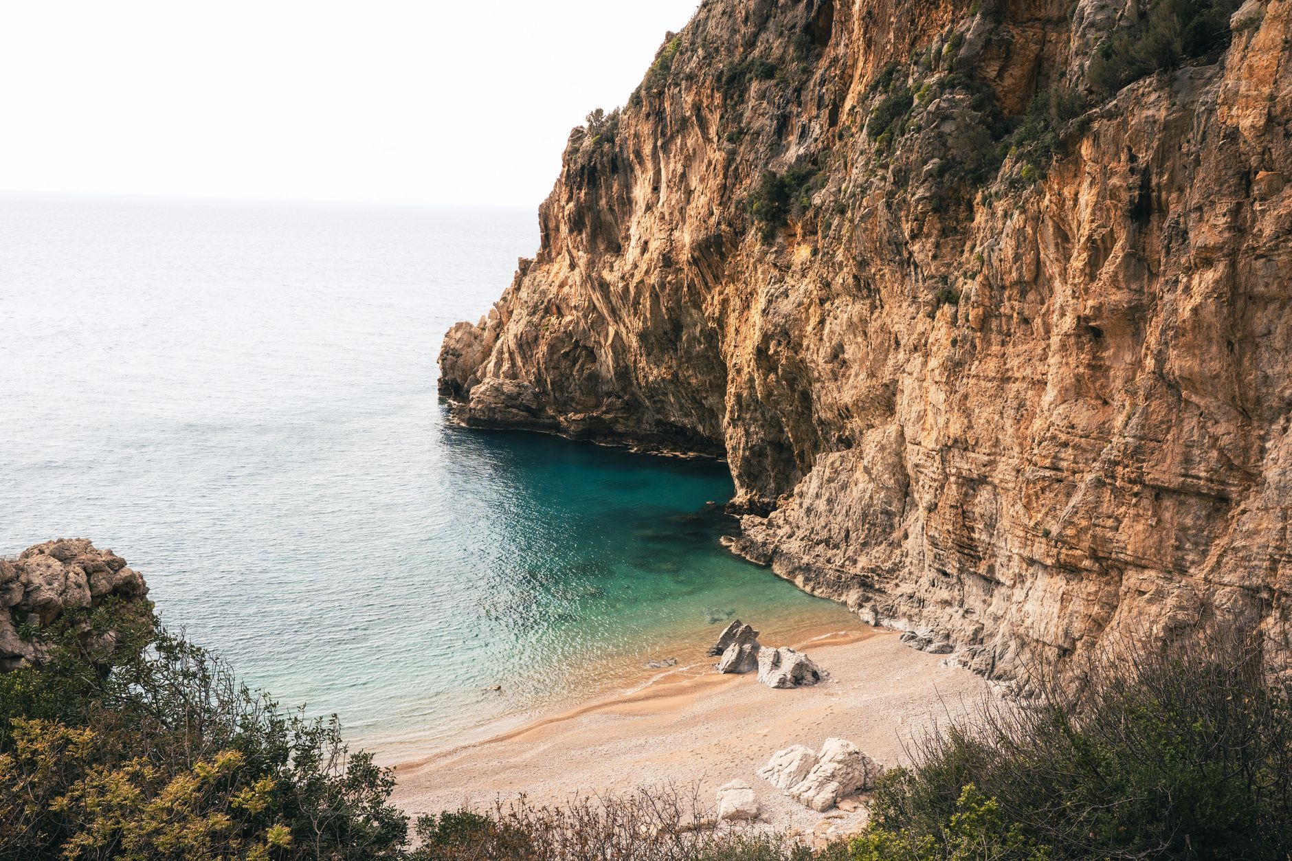
If you've ever stood on a Menorcan cove — powdered white sand, turquoise water so clear you can count the pebbles three metres down, and not a hotel in sight — and wondered how on earth this survived the package-holiday boom that transformed so much of the Mediterranean, you're asking exactly the right question. The answer isn't luck. It's a legal and conservation framework that deliberately, systematically kept the bulldozers out. Understanding that framework is the single most useful thing you can do before planning a visit, because it tells you which beaches exist, how to reach them, and how to behave once you're there.
What a UNESCO Biosphere Reserve Actually Means for Menorca
UNESCO's Man and the Biosphere programme designates regions where human activity and natural ecosystems are managed together, rather than in opposition. Menorca received this designation in 1993, making it one of the earlier island reserves in Europe. The designation isn't just honorary; it shapes planning law, coastal access rules, and land-use decisions at a local government level.
In practice, the reserve divides the island into concentric zones. A core zone — typically the most ecologically sensitive areas — receives the strongest protection, with very limited human access and virtually no infrastructure permitted. A buffer zone surrounds it, where low-impact activities are allowed but development is tightly controlled. An outer transition zone is where most residents live and work, and where managed tourism operates. Many of Menorca's hidden coves sit either inside the buffer zone or at its edge, which is precisely why they remain undeveloped.

As an Amazon Associate, I earn from qualifying purchases.
Crucially, Menorca's biosphere designation came at a turning point. By the early 1990s, Mallorca and Ibiza had already been extensively developed. Menorca, having recovered slowly from economic stagnation, still had intact coastal scrubland, wetlands, and undisturbed cove systems. The UNESCO status gave local planners the legal backing to resist the development pressure that had already reshaped neighbouring islands.
💼 Career Opportunities
The Camí de Cavalls: Your Map to the Secret Coastline
You cannot understand Menorca's secret beaches without understanding the Camí de Cavalls. This ancient coastal path — literally "the path of horses" — rings the entire island, originally built to allow mounted soldiers to patrol and respond rapidly to coastal raids. It fell into disuse and became partially privatised over centuries, with landowners absorbing sections into their estates.
What makes the modern story remarkable is that Menorca's regional government spent years legally restoring public access to the full route, completing the project in the early 2000s. The result is a waymarked trail of around 185 kilometres that hugs almost the entire coastline, dipping into ravines called barrancs, crossing headlands, and descending to coves that have no road access whatsoever. If a beach requires a 40-minute walk along the Camí de Cavalls to reach, it simply doesn't have a car park. Which means it doesn't have a beach bar. Which means it stays quiet.
This walking trail is arguably the most important piece of infrastructure for anyone seeking unspoiled beaches. The path is well-maintained and well-signed, but the terrain varies significantly. The northern coast — the Tramuntana — is rockier, more exposed, and more dramatic, carved by the fierce north wind that gives that coast its name. The southern coast is gentler, with deeper inlets and calmer water. Both have their rewards, and the beaches accessible only on foot along either stretch are among the finest in the Balearic Islands.
As an Amazon Associate, we earn from qualifying purchases.
North vs South: Two Completely Different Coastlines
The Wild North (Tramuntana Coast)
The northern coast bears the full force of the Tramuntana wind, and the landscape shows it. Vegetation is low, gnarled, and salt-pruned. The rock is reddish-brown sandstone, and the coves, when you find them, tend to be smaller and more dramatic. Beaches like Cala Pregonda, with its extraordinary rust-coloured rock formations, are only reachable on foot — typically a 30 to 40-minute walk from the nearest parking area. The geology here is genuinely striking, and the combination of reddish rock, dark scrubland, and vivid blue water is unlike anything else in the Mediterranean.
Because the north sees fewer visitors (most tourists gravitate toward the calmer southern beaches), the sense of solitude is more reliable, even in high summer. You'll share a cove with a handful of people rather than hundreds.
The Sheltered South (Migjorn Coast)
The southern coast is where Menorca's most celebrated secret coves cluster. The water is calmer, the sand is finer and whiter, and the pine forests that line the cliffs give the coves a particular quality of light and shade. Beaches along the Migjorn — places like Cala Macarelleta, Cala Trebalúger, and Cala Fustam — have become the standard image of unspoiled Menorca, and for good reason.
Cala Macarelleta, the smaller sibling of Cala Macarell, is a classic example of how the protection regime works in practice. There is no road to it. You walk, or you arrive by boat. That single constraint filters the crowd dramatically. What you get is a crescent of white sand in a limestone amphitheatre, with water that shifts from pale turquoise at the shore to deep blue further out. It exists because the biosphere reserve prevented the construction of a road that would have, inevitably, been followed by a beach bar, then a car park, then accommodation.
How to Actually Find and Reach These Beaches
Here is the practical intelligence that most visitors miss. The key resource is the official mapping of the Camí de Cavalls, which is available as a detailed topographic map and through several GPS tracking apps. The path is divided into 20 numbered stages, and each stage gives you access to specific coves. Before you go, identify which stage covers the beach you want, check the distance and elevation, and plan accordingly.
A few practical notes:
- Start early. In July and August, popular coves fill by mid-morning. The path itself is often shaded by pines, but the beaches are not. Early starts also mean cooler walking conditions.
- Carry water. There are essentially no facilities on the path between villages. The biosphere reserve's restrictions on development mean you won't find a kiosk at the end of your walk.
- Wear proper footwear. The path varies between smooth limestone, loose gravel, and rocky coastal scrambles. Flip-flops are inadequate for most sections.
- Understand anchoring rules. If you're arriving by boat, be aware that Menorca has designated anchor-free zones around its most sensitive posidonia seagrass meadows. Posidonia is a protected marine plant that is fundamental to the clarity of the water and the health of the marine ecosystem. Anchoring in these zones is prohibited and actively enforced.
The Role of Posidonia: Why the Water Is That Colour
One question visitors consistently ask is why Menorcan water is so extraordinarily clear compared to many other Mediterranean destinations. The answer is posidonia oceanica, an endemic Mediterranean seagrass that forms vast underwater meadows in the shallow waters around the island. Posidonia acts as a water filter and a sediment stabiliser, and the combination produces that quality of light, clarity, and turquoise colour that defines Menorcan coves.
The biosphere reserve's marine protections — including anchoring restrictions and controls on motorised water sports in certain zones — are designed specifically to protect these meadows. Posidonia grows extremely slowly and takes decades to recover from damage. Its preservation is not incidental to the beaches being beautiful; it is the direct cause.
Specific Beaches Worth Knowing
Cala Trebalúger
One of the few beaches on the south coast with a permanent freshwater stream flowing onto it, creating a distinctive ecosystem of reeds and wetland vegetation at the back of the cove. No road access. The walk in is roughly 30 minutes from the nearest point reachable by vehicle, through pine forest. The combination of fresh and saltwater attracts birdlife that you won't find at more accessible beaches.
Cala Fustam
Smaller and less frequented than its neighbours, Cala Fustam sits in a deep inlet surrounded by pine-covered cliffs. The walk is shorter than many comparable coves — around 20 minutes — but the path is steep enough to deter casual visitors. The water is shallow and calm, and the pine canopy at the cliff edge provides afternoon shade directly onto the beach.
Cala Pregonda
On the north coast, Pregonda is worth the effort specifically because the landscape is so different from the southern coves. The reddish rock formations, the small islets offshore, and the rougher character of the beach make it feel more adventurous. The walk is around 40 minutes and passes through coastal scrubland that, in spring, is carpeted with wild flowers.
Cala en Turqueta
Probably the most-photographed "secret" beach on the island, which means it is no longer much of a secret in summer. However, the strict parking limitations imposed under the biosphere reserve's management plan mean that the number of visitors is capped by the number of spaces at the nearest car park, which fills early. Arrive before 9am in high season, or walk from further away. Out of season, it's as quiet as any beach on the island.
Beyond the Beach: The Broader Protection Landscape
The biosphere reserve doesn't just protect beaches. The same framework preserves the barrancs — the ravine systems that cut through the island's interior and provide some of the best hidden hiking trails in the Balearics. The Barranc d'Algendar, for instance, is one of the longest and most ecologically diverse ravines in the Mediterranean, running from the central plain down to the coast at Cala Galdana. Walking it gives you a cross-section of the island's geology, birdlife, and traditional land use in a single half-day route.
The reserve also encompasses Menorca's wetlands, prehistoric sites, and traditional agricultural landscape of dry-stone walls and white farmhouses. All of this contributes to the island's character as a place that functions differently from standard Mediterranean resort destinations. The protection isn't cosmetic; it's structural.
The Practical Ethics of Visiting Unspoiled Places
Understanding why Menorca's beaches are unspoiled carries an implicit responsibility. The pressure on even the remotest coves increases every summer as awareness grows. A few principles that preserve what you came to find:
- Take everything you bring. Rubbish disposal facilities don't exist on remote coves because facilities don't exist on remote coves. Plan accordingly.
- Stay on the path. The coastal scrubland is fragile. The Camí de Cavalls is marked for a reason; cutting across vegetation to reach a beach faster damages what you came to see.
- Don't light fires. The pine forests along the southern coast are at serious risk from fire in summer. This is both a legal prohibition and an obvious common sense rule.
- Respect the water quality zones. If you're snorkelling or swimming, avoid disturbing posidonia beds. The plants anchor the entire ecosystem.
When to Go
The honest answer is: not July or August, if solitude is what you want. The shoulder seasons — late May through June, and September — offer near-identical water temperatures to peak summer, far smaller crowds, and the particular quality of Mediterranean light that makes early and late season travel so rewarding. Spring also brings the interior of the island into vivid colour, which makes the walking between beaches far more interesting.
October is underrated. The sea retains summer warmth well into autumn, the Camí de Cavalls is almost deserted, and many coves are genuinely empty on weekdays. The trade-off is that some facilities in nearby towns operate reduced hours, but for anyone whose priority is the beach itself rather than the surrounding infrastructure, this is barely a trade-off at all.
The Bigger Picture: What Menorca Demonstrates
Menorca's coastline is a working example of what conservation designation can actually achieve when it's implemented with legal teeth and local political support. The comparison with Mallorca and Ibiza — not criticisms of those islands, simply facts about different developmental paths — makes the outcome visible. Decisions made in the 1990s are still producing beautiful beaches thirty years later. That's a timeframe worth keeping in mind when you're standing in a cove that feels like it belongs to no particular century, watching the posidonia sway in water so clear it seems implausible.
The beaches exist because someone decided they should. Going to find them is, in a small way, an endorsement of that decision.