Most waterfalls announce themselves. You hear the roar before you see the mist, and the trail leads you straight to the edge of the drop. But in the Appalachian highlands and across the Ozark Plateau, waterfalls routinely disappear underground, emerge from cliff faces with no obvious source, plunge into pools hidden inside caves, or simply vanish into the earth entirely. This isn't quirky geography — it's the predictable result of karst, a landscape shaped almost entirely by the slow dissolution of limestone. Understanding the geology explains not just where these waterfalls hide, but why they exist in forms you won't find in granite-and-gneiss mountain ranges like the Rockies or the Sierra Nevada.
What Karst Actually Means
The word karst comes from a German rendering of a Slovenian place name — the Kras plateau along the Adriatic coast — where European geologists first systematically studied this type of terrain. Today it describes any landscape where soluble bedrock, most commonly limestone or dolomite, has been chemically eroded by slightly acidic water to create a distinctive suite of features: sinkholes, caves, springs, sinking streams, and dry valleys where rivers once ran on the surface.
The chemistry is elegant in its simplicity. Rainwater absorbs carbon dioxide from both the atmosphere and the soil, forming a weak carbonic acid. When this water contacts calcium carbonate — the primary mineral in limestone — a reaction occurs that converts solid rock into dissolved ions that water can carry away. Over hundreds of thousands to millions of years, this process hollows out the subsurface into a hidden plumbing system of conduits, passages, and chambers. The same rock that looks solid underfoot is, in places, more hole than stone.

As an Amazon Associate, I earn from qualifying purchases.
The Appalachian and Ozark Context
The Appalachian Mountains contain some of the most extensive karst terrain in North America, particularly in the Valley and Ridge province that runs from Pennsylvania through Virginia, Tennessee, and into Alabama. Here, alternating bands of limestone, shale, and sandstone were folded and faulted during ancient mountain-building events. The limestone bands dissolved preferentially, creating long valleys underlain by karst while the more resistant sandstone ridges stood firm. Water in these valleys doesn't simply flow downhill in tidy channels — it seeps into fractures, travels underground for miles, and resurfaces unpredictably as springs or cave-mouth streams.
💼 Career Opportunities
The Ozark Plateau, centered across Missouri, Arkansas, and Oklahoma, is one of the largest karst regions in North America, underlain by thick sequences of Ordovician and Mississippian-age limestone and dolomite. Unlike the folded Appalachians, the Ozarks are a broad, relatively flat-topped dome that streams have been dissecting for millions of years. The result is a deeply carved plateau where rivers have cut down through hundreds of feet of soluble rock, exposing cave systems, spring-fed hollows, and waterfall-producing bluffs at nearly every bend.
Both regions share the key ingredient that makes their waterfalls so unusual: the bedrock beneath a moving stream is not just an inert floor. It's an active participant in routing the water, sometimes stealing the stream entirely.
How Karst Geology Creates Unusual Waterfalls
Sinking Streams and Disappearing Rivers
In a granite landscape, a river is a river. It flows continuously from headwaters to mouth, visible on the surface the entire way. In karst country, rivers routinely flow to a point — sometimes called a swallet, sinkhole, or losing stream — where the water drops into the ground and continues underground. The surface channel goes dry. Downstream, the same water may re-emerge miles away as a spring with no surface connection in between.
As an Amazon Associate, we earn from qualifying purchases.
This creates what are sometimes called waterfall inversions: instead of water falling over a cliff edge, water plunges into a hole in the streambed and cascades through an underground shaft. These features — technically called ponors or stream sinks — are among the most dramatic and least-visited waterfalls in America because they require knowing not just where to look, but understanding that a waterfall can flow downward into the earth rather than off a ledge into open air.
Cave Waterfalls and Hidden Plunge Pools
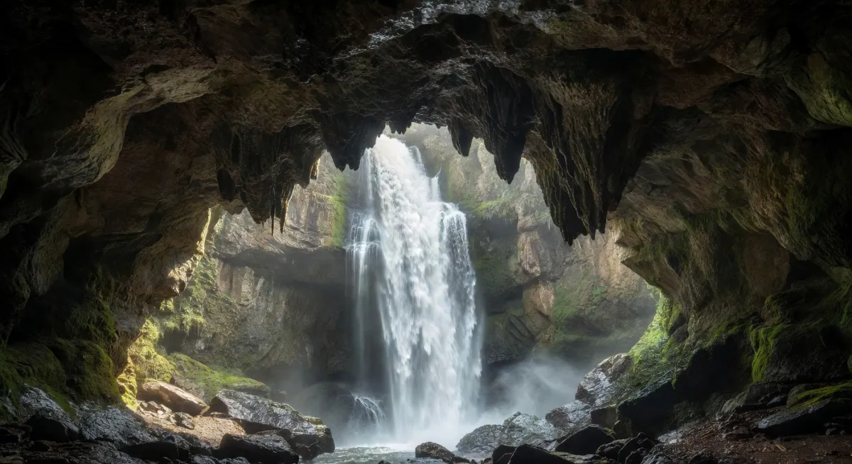
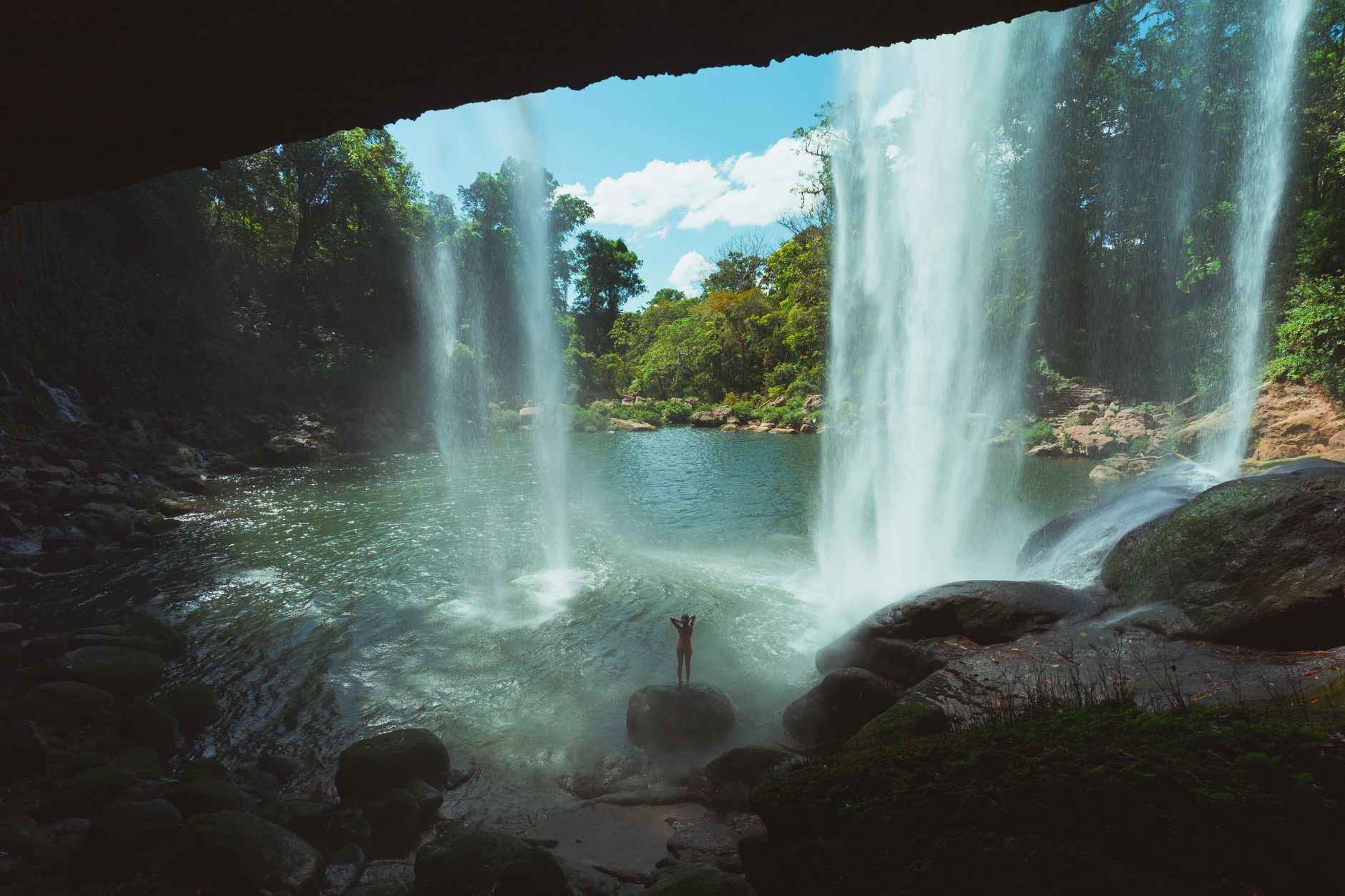
When a surface stream crosses a cliff face that is honeycombed with cave passages, the water doesn't always wait until it reaches the edge to fall. It seeps into cracks, finds a cave entrance partway down the bluff, and emerges mid-cliff as a waterfall that seems to spring from the solid rock. The plunge pool at the base of such a waterfall is often enclosed on three sides by overhanging limestone, forming a grotto — a naturally sheltered chamber that visitors can walk behind or even into.
These grotto waterfalls are emblematic of Ozark and Appalachian canyon country. The overhang exists because the rock at the base of a limestone bluff dissolves faster than the rock above it — water pools and seeps at the base longer than it contacts the upper face — undercutting the cliff and creating that characteristic concave recess. Some grottos are large enough to shelter dozens of people. Because they face inward rather than cascading visibly over an open cliff, they're easy to miss from a trail that doesn't lead directly to them, which is precisely what makes them feel so secret. Exploring them is part of what draws adventurous hikers to hidden hiking trails through karst country.
Travertine Dams and Staircase Falls
Karst geology doesn't only dissolve — it also deposits. When water that has been dissolving limestone underground re-emerges at a spring and suddenly loses its dissolved carbon dioxide load, the reverse reaction occurs: calcium carbonate precipitates out of solution as a mineral called travertine (or its softer cousin, tufa). This precipitation can happen rapidly enough — geologically speaking — to build physical structures in the streambed.
Travertine accumulates on sticks, leaves, moss, and algae in a stream, eventually hardening into a series of natural dams that create staircase waterfalls. Each step in the staircase is a travertine rim, and each pool behind it is a natural aquarium of remarkably clear blue-green water, colored by the mineral content and the clarity that comes from water filtered through hundreds of feet of limestone. These formations are fragile — footsteps can damage decades of travertine growth — and they appear in some of the most ecologically sensitive corners of both the Ozarks and the southern Appalachians.
Spring-Fed Waterfalls
Perhaps the most common hidden waterfall type in karst country is the spring waterfall: a stream that begins not from a visible watershed draining rainfall off a hillside, but directly from the ground, where an underground aquifer has found its exit point. These springs can produce impressive volumes of water year-round, even during droughts that leave surface streams as trickles, because the underground aquifer system draws on a vast catchment area that may extend many miles in any direction.
A spring-fed waterfall often appears in an otherwise dry hollow, emerging from a cave mouth or a fracture in a bluff, dropping into a pool of water that maintains a near-constant temperature regardless of season. In summer, the water feels cold because it reflects the average annual ground temperature. In winter, it appears to steam because the air is colder than the water. This thermal stability also supports unique biological communities — plants and animals that depend on the consistent conditions that surface-fed streams can't provide.
Why These Waterfalls Stay Hidden
The geography of karst valleys actively conceals its own features. Sinkholes interrupt trails. Bluff lines retreat from ridgelines, so you might walk an entire ridge without ever knowing a 60-foot grotto waterfall exists in the hollow below you. Streams that reach a swallet simply end — without knowing to look underground, you'd assume the drainage is insignificant. And the same limestone that dissolves to form caves also weathers into dense forest soils that support thick vegetation, further screening the terrain from casual observation.
Navigation in karst country rewards a specific kind of attention: watching for topographic anomalies, following the sound of water that has no visible source, noticing where streams simply stop. The secret waterfalls of the Ozarks and Appalachians tend to belong to people who understand the underlying geology well enough to know where to look.
What Makes Karst Waterfalls Geologically Distinct
Compare a karst waterfall to one on a granite or volcanic landscape and the differences become clear. In hard crystalline rock, water carves channels purely by mechanical erosion — the force of moving water and the abrasion of sediment. The process is slow, the forms are predictable, and the relationship between surface and subsurface is simple: what you see is what there is.
In karst, chemical dissolution works in three dimensions simultaneously. A stream can be eroding its bed downward while also losing water through the floor, while also undercutting the walls laterally, while also depositing travertine a hundred yards downstream. The landscape is not a static stage on which water performs — it's a reactive system where rock and water are constantly exchanging material. This is why karst waterfalls feel alive in a way that granite waterfalls, for all their grandeur, often don't.
Reading the Landscape Before You Go
If you want to find hidden waterfalls in karst country, geological and topographic maps are more useful than standard hiking guides. Look for contour lines that show steep-sided hollows (called hollers in Appalachian vernacular) cutting into plateau surfaces — these are often carved by streams that have since gone underground, leaving the valley as a dry or intermittent channel except where springs emerge. Look for blue symbols on USGS maps marked as springs. Look for cave entrances marked on geological survey maps, because a mapped cave entrance in a bluff face is often a waterfalls entrance too, when rainfall is sufficient.
Understanding karst also means understanding its hazards. Sinkholes can be unstable. Cave passages flood rapidly during rain events, and a waterfall that's a gentle trickle in dry weather can become a lethal torrent within hours of a storm. The same geology that hides beautiful plunge pools also hides underground flash floods. Respect the terrain as the dynamic, water-reactive system it actually is, and karst country will show you features that most people never suspect exist beneath the ordinary-looking hills.
A Landscape That Rewards Curiosity
Karst is ultimately a geology of hidden depths — literally. The Appalachian and Ozark waterfalls that feel most like discoveries are usually the ones where limestone has been quietly working for millions of years: dissolving, depositing, redirecting water underground and returning it to the surface in forms that make no sense by the rules of ordinary hydrology. That sense of impossibility — water pouring from solid rock, streams vanishing into the earth, plunge pools tucked inside hillsides — is not a trick of perception. It's the accurate observation of a landscape that operates by its own rules, carved by chemistry as much as by gravity, and well worth the effort of learning to read.
Sources
Every factual claim in this article was independently verified against the following sources:
- Ozarks — en.wikipedia.org